Lemosho Northern Circuit Route
The longest and most remote route with amazing 360 degree views!
Note: Our 2026 Itinerary is typically an 9 day climb
HOW CHALLENGING IS THE NORTHERN CIRCUIT?
The Northern Circuit begins by following the Lemosho Route. For the first two days, the trail winds through lush rainforest at the base of the mountain before climbing up the Shira Ridge and crossing the expansive Shira Plateau.
Upon reaching Lava Tower, the route diverges from the Lemosho trail and veers north, continuing along the Northern Circuit path.
This northern detour allows trekkers to loop around Kilimanjaro’s remote northern slopes, eventually linking up with the Rongai Route. The northern side is notably quieter, offering a more secluded experience away from the busier southern routes.
Taking this path offers a truly unique journey, granting climbers sweeping 360-degree views of Kilimanjaro and the surrounding plains.
As the longest and most remote option to the summit, the Northern Circuit benefits from an extended itinerary that supports optimal acclimatization. The ability to “climb high, sleep low” enhances the body’s adaptation to altitude.
While the route requires sustained hiking over long durations, it doesn’t involve any technical climbing. A good level of physical fitness is advisable.
The total trekking distance from start to finish is approximately 97 kilometers.


Example Northern Route Itinerary
DAY 1 - LONDOROSSI GATE TO MTI MKUBWA CAMP
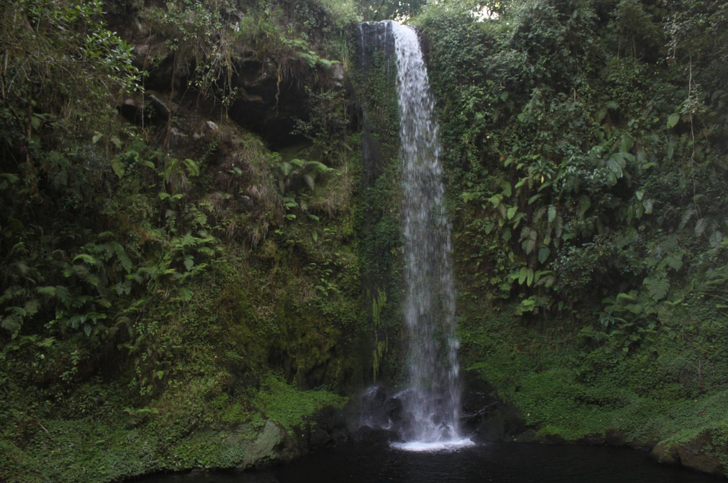
Following breakfast, you’ll head to Londorossi Gate to meet your porters and complete the necessary registration at the Ranger’s Office. From there, the trek begins through the rainforest along a scenic trail, leading to Mti Mkubwa Camp (2,895m)—which translates to "big tree" in Swahili—where you will spend the night.
Trekking distance: 6 kilometers
Trek time: 3 to 4 hours
Environment: Montane Forest
Elevation: From 2360 meters to 2895 meters
DAY 2 - MTI MKUBWA CAMP TO SHIRA ONE CAMP
Leaving the forest behind, we enter the moorland zone, where the trail gradually ascends and opens up to expansive views leading toward the edge of the Shira Plateau. As the vegetation becomes increasingly sparse, Shira One Camp (3,600m) comes into view—your resting place for the night. The sense of wilderness becomes even more pronounced if afternoon mist rolls in.
Trekking distance: 9 kilometers
Trek time: 6 to 7 hours
Environment: Moorland
Elevation: From 2895 meters to 3600 meters
DAY 3 - SHIRA ONE CAMP TO SHIRA TWO CAMP
As we make our way to Shira Two, we take time to explore the volcanic rock formations scattered across the Shira Plateau. Once Kilimanjaro’s third and lowest volcanic summit, Shira has long since eroded into a broad high-altitude plateau. The hike eastward to Shira Two is a gentle one, winding through moorland meadows dotted with vibrant wildflowers and the strikingly unique Senecio trees.
Trekking distance: 7 kilometers
Trek time: 3 to 4 hours
Environment: Moorland
Elevation: From 3600 meters to 3900 meters
DAY 4 - SHIRA TWO TO MOIR HUT
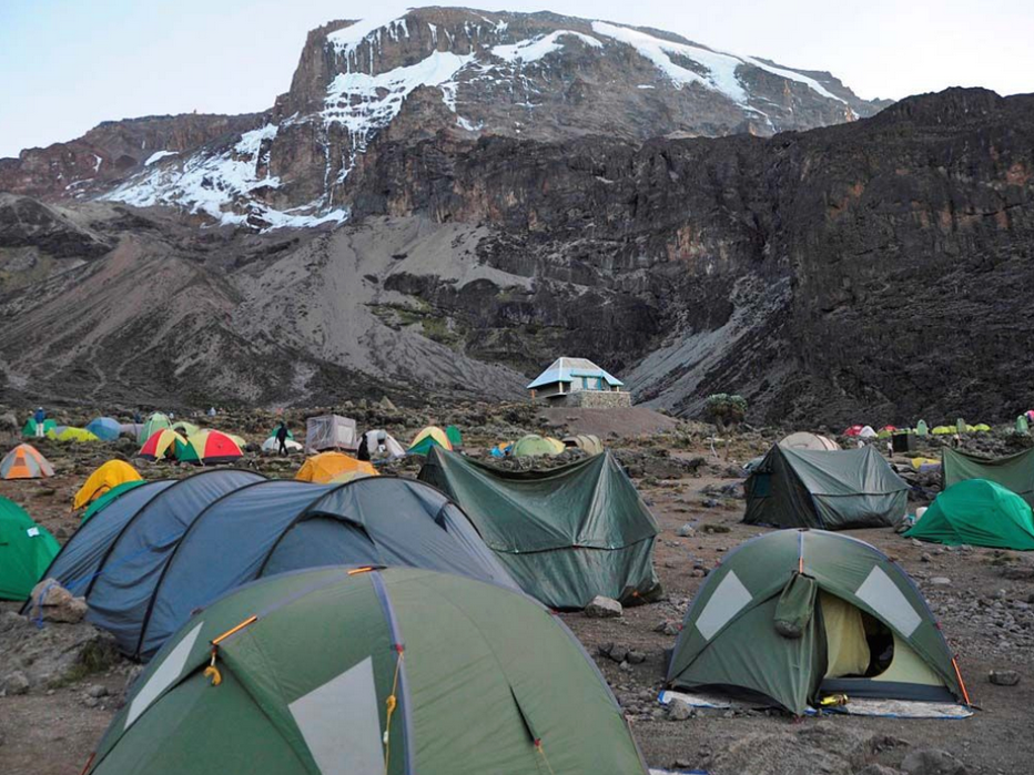
Today’s journey is a lengthy trek heading east, passing through the picturesque 'Garden of the Senecios' before ascending into the high alpine desert. The morning is spent climbing toward Lava Tower (4,600m) and the distinctive Shark’s Tooth rock formation, where a hot lunch will be served. Following lunch, you’ll join the Northern Circuit and descend to Moir Hut (4,200m). This day plays a key role in your acclimatization, as you’ll experience higher altitude before sleeping lower—a proven strategy for adapting to elevation.
Highest point: 4600 meters (at Lava Tower)
Trekking distance: 4 kilometers
Trek time: 5 to 7 hours
Environment: Alpine desert
Elevation: From 3900 meters to 4200 meters
DAY 5 - MOIR HUT TO BUFFALO CAMP
The day begins with a moderately steep ascent out of Moir Valley. For those interested, there’s an optional detour to summit Little Lent Hill (4,375m) before rejoining the main Northern Circuit trail. The path then winds through a series of gentle ascents and descents, tracing the northern slopes of Kibo en route to Buffalo Camp. Along the way, you’ll be treated to sweeping views of the plains stretching north toward the Kenyan-Tanzanian border. You’ll reach Buffalo Camp (4,020m) shortly after midday, where lunch will be served and you’ll have time to relax and recover.
Trekking distance: 12 kilometers
Trek time: 5 to 7 hours
Environment: Alpine desert
Elevation: From 4200 meters to 4020 meters
DAY 6 - BUFFALO CAMP TO RONGAI THIRD CAVE
Day seven begins with an ascent over Buffalo Ridge, followed by a descent into Pofu Camp, where you'll stop for lunch. The journey then continues eastward, wrapping around Kilimanjaro’s northern slopes toward the Rongai Third Cave (3,936m). Today’s hike is shorter than the previous day, and by now you should be feeling more adjusted to the altitude. You’ll reach Third Cave in the early to mid-afternoon.
Trekking distance: 6 kilometers
Trek time: 4 to 6 hours
Environment: Moorland
Elevation: From 4020 meters to 3936 meters
DAY 7 - RONGAI THIRD CAVE TO SCHOOL HUT
The day involves a steady climb across the Saddle, the expansive ridge that lies between Kibo and Mawenzi peaks. From there, the route continues southwest to School Hut (4,800m), where you’ll have an early dinner and head to bed in preparation for your summit attempt, which begins just before midnight.
Trekking distance: 6 kilometers
Trek time: 4 to 6 hours
Environment: Alpine desert
Elevation: From 3936 meters to 4800 meters
DAY 8 - SCHOOL HUT TO UHURU PEAK TO MILLENIUM CAMP
In the very early hours of the morning, around midnight, we begin our final ascent to the summit. This part of the journey is both mentally and physically the toughest. The cold and wind at this altitude can be harsh and relentless. We climb through the darkness for several hours, pausing often but only briefly. Upon reaching Gilman’s Point, you’ll be greeted by one of the most breathtaking sunrises imaginable, illuminating Mawenzi Peak. At last, we reach Uhuru Peak, the highest point in Africa. From there, we descend along the Mweka route down to Millennium Camp at 3,790 meters.
Highest point: 5895 meters (Uhuru Peak)
Trekking distance: 16 kilometers (6 kilometers ascent / 10 kilometers descent)
Trek time: 12 to 15 hours (6 to 7 hours ascent / 6 to 8 hours descent)
Environment: Alpine desert to Glacial zone to Moorland
Elevation: From 4800 meters to 5895 meters to 3790 meters
DAY 9 - DESCENT FROM MILLENIUM CAMP TO MWEKA GATE
The last day involves a brief trek through the lush montane rainforest, descending from Millennium Camp (3,790m) to Mweka Gate (1,630m). Upon arrival at the gate, you’ll check out with the officials, who will present you with your official certificate — a green certificate for those who reached Gilman’s Point and a gold certificate for those who made it all the way to Uhuru Peak.
Trekking distance: 10 kilometers
Trek time: 3 to 4 hours
Environment: Moorland to Montane forest
Elevation: From 3970 meters to 1800 meters
Note: The itineraries above are examples and can change slightly depending on weather, hiking speed and ability. We work to ensure safety at all times, and where inclement weather might make a particular path or side-trip unsafe, our lead guides will adjust accordingly.